Thursday, February 18, 2010

Sculptured Beach


Did you say you want a nice secluded beach with tide pools that hardly anyone visits (at least since I posted this?) Then you have found the right beach. This hike is entirely on the beach and it starts at Limatour Beach. Something that is odd is how Limatour Beach is almost as wide as Stinson, does not have dangerous surf but many people visit Stinson Beach but only a few visit Limatour. It must be that some people want a more developed beach but for me, I love it when it is desolate. Recently, Limatour Beach and the surrounding area are becoming more popular as people spill over from Stinson Beach. Still, Sculptured Beach should have a few people only on the heaviest beachgoing days.

Difficulty: Easy
Terrain: Flat and sandy. No shade
Crowds: Small but in the summer, Limatour Beach will have a fair crowd.
Best times: Good anytime, best at low tide near the full moon.
Length: 3 to 5 miles round trip, depending how far you walk along the beach.

Directions: The drive out to Limantour Beach is about an hour long from San Anselmo and from Mill Valley, it is closer to 70 minutes. From San Anselmo, take Sir Francis Drake up to Bear Valley Rd, turn left on Bear Valley Rd until you hit Limatour Rd. From Mill Valley, take Shoreline Highway until you reach Bear Valley Rd in Olema. The road up to Limantour Beach appears to resemble Fairfax Bolinas Rd but Limatour Rd is actually not a roller coaster. The drive combines views of the ocean that make Point Reyes famous and Douglas Firs that put you into a deep forest. you hit the beach parking lot, there is a short walk there, keeping the beach more natural. Take the nearest trail out to Limantour Beach. If you wanted to look at other habitats besides the beach, the trail passes over a bridge through a salt marsh so the walk brings together two habitats of California's coast. I would suggest in parking in the parking lot to the left because it is about 0.2 miles closer to Sculptured Beach than the first parking lot. Sculptured Beach is about a 2 mile walk one way from Limatour Beach.

The hike: Once you leave the parking lot, turn to the left. The walk to Sculptured Beach begins with the dunes. Gradually, the dunes begin to rise and they change to little cliffs and then large cliffs. There are no tidepools yet but you should see a few seagulls and the gentle surf. Chimney Rock should be visible to the right and the views to the south extend to Millerton Point which is about 6 miles from Bolinas. There should be few people to begin with on the hike but the further you walk away, the less people there are. These people are mostly locals. This may change soon because Limantour Beach is becoming a hot spot and people may venture further and further away from the beach near the parking lot. 1.4 miles into the hike, you should pass a creek emptying into the sand. A path follows the creek which leads to Coast Camp. During the winter, you may have to get your feet wet by passing the creek but it is not too difficult to cross. It's the beach so you should expect to get wet anyway. About ten minutes later, you should reach Sculptured Beach. Rocks make this landscape rock by creating all the tide pools. Remember not to disturb the wildlife in the tide pools because this is a sensitive wildlife area. However, you should snap away with the camera. The terrain of the rocks is not all the same. Some rocks are jagged and tall, some are short but the ones closest to the water are tall and flat. Be careful if you have to walk on these rocks, they are slippery.

The rocks at Sculptured Beach start with a big group of them which have fantastic photo opportunities. Many of these rocks have mussels and barnacles. In the tidepools, I saw some hermit crabs, sea anenomaes and even a few starfish. Expect to see seagulls congregating here. Do not feed them because they will become dependent on humans if you do. Then there is a short stretch without any rocks. Then the rocks return. Earlier, the rocks close to the coast were easy to walk in but now, it is more dangerous to go right next to the coast. The rocks now extend to the cliffs. Once you climb those rocks, there is a small flat area and a drop of about 7 ft into a short tunnel. Water covers the sand unless it is a minus tide from this point out so plan around the tides. There are even more grander rock formations, tide pools and some caves.

Overall, this is the perfect beach for escaping crowds, photos, a reward after a nice walk on the beach and observing tide pools.

A few quick reminders:
Check the tides before you visit Sculptured Beach because during high tide, the tide pools will not be visible. Also, low tide at Point Reyes hits about 40 minutes earlier than Golden Gate tides. The descriptions of Sculptured Beach are all in the low tide. During high or even medium tide, most of the rocks except the ones close to the coast are shrouded by water.

I mentioned this already but remember to leave this beach better than you found it which basically means do not leave litter and pick up litter you see. This beach needs to remain beautiful.
Saturday, February 13, 2010

Kent Pump Fire Road


Redwoods, waterfalls, easy for the kids, good for biking, this hike has it all. So why is it almost empty? I hiked on this trail last weekend when the waterfall was just pouring down Alpine Dam. The parking spots on the side of the road were mostly full and I bet Cataract trail was stuck in a traffic jam. Once we walked onto Kent Pump FR, we saw only a few people on our 4 mile hike...and this day the trail was supposed to be packed. So what is keeping people from hiking Kent Pump FR? Do not say it is the drive, Cataract trail is a minute away and that trail is not empty during waterfall season. My guess is that this trail is undiscovered. Here are the directions along with the details of the hike:

Difficulty: Easy
Terrain: Mix of Douglas Fir and Redwood. Almost flat except for short downhill in the begining.
Crowds: Small
Best times: Good year round but best in the spring or after a heavy rain.
Length: 4.2 miles round trip.

Directions: Drive up Sir Francis Drake Blvd. until you hit downtown Fairfax. Turn onto Center Ave and to your left, you will see Fairfax Bolinas Rd. Go on the road until you reach Alpine Dam which is about 20-30 minutes from downtown Fairfax. At Alpine Dam, there are some parking spots and a fire road going into the canyon. Park in the parking spots there and the fire road will be your hike.

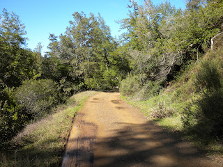
The hike: A gate blocks the fire road but it is perfectly fine to access it. Climb over the gate and you will begin the downhill. This is the only downhill of the entire hike, the rest of it will be almost level. Immediately, the scenery turns into a mixed forest with some redwoods. The downhill is not too steep because rangers sometimes drive down here to go to Kent Lake which this fire road will lead to eventually. The downhill levels out once the fire road is close to Lagunitas creek. A shorter fire road goes to the left, heading towards the Dam. At first, this fire road appears to be an alternate route to the trail head. The short route is covered in redwoods and once it reaches a small building at the Dam, there is a keep out sign. Right next to the Dam, there is another sign saying "keep out, this means you." They have a good reason because the waterfall out of Alpine Dam makes the Dam need a big "caution wet floor sign."
Back to the main fire road: The fire road is about ten feet away from the creek for about 0.3 miles and the redwoods dominate on the left side while the right side is a mixed forest. Soon, the fire road turns to the right and the views start to open towards Bolinas Ridge. The spots between the trees showing views of Bolinas Ridge are good photo oppurtunities. The lovely redwood filled area between Bolinas Ridge trail and Lagunitas Creek is trailless. The terrain starts to change as the forest becomes more of a Douglas Fir/hardwood forest. At about this point, there is a partially dead tree that sticks up and is a a great photo oppurtunity. The fire road still does not leave the trees who accompany it for the rest of the hike. 2.1 miles in, the trail meets Old Vee FR and the hike ends.

Additional options: You can easily continue on Kent Pump FR which continues for another 2.4 miles through the same mixed forest, mostly level terrain. It ends at Kent Lake. You can also climb up Old Vee FR which rises steeply to Oat Hill FR 1.1 miles away. There is a loop option by continuing on Kent FR to Big Trees trail. This trail then rises slowly at first but then steeply toward Carson Falls (nice but overrated) and then goes to Oat Hill FR. The loop ends by continuing on Oat Hill FR to Old Vee FR and back to Kent Pump FR. I personally would not recommend the loop because it is steep and 8 miles long. But go ahead and make up your own mind.

Thursday, February 11, 2010

Northside of Mt. Tam


When you think of driving up East Ridgecrest Rd, you would think of taking the 0.6 miles round trip up to East Peak or hiking 0.7 miles on the Verna Dunshee trail loop around East Peak. Do not get me wrong, I love those trails because you can see the Farallon Islands (and further,) mountains as far as Mendocino County, the Sierras on the clearest of days, your house, your friend's house and your friend's friend's house. Okay, this is a bit off topic but you get the point. The problem with the East Peak is that you might be stuck behind a line of people who want the best viewing spots too. Did you know there are hikes around East Peak that are fantastic but are not crowded on those summer weekends? The Eldridge Grade, Northside and Colier hike is 4.5 miles long and it traverses through all of Mt. Tam's climates: chaparral, mixed forest, douglas fir forest and redwoods.

Difficulty: Moderate
Terrain: Mix of Douglas Fir, hardwood, chaparral. One extremely steep part.
Crowds: Small
Best times: Fall, winter or spring. The summer brings tons of flies.
Length: 4.5 miles

Directions: From Mill Valley: drive up Shoreline Highway to Panoramic Highway. Continue on Panoramic Highway until you reach Pantoll Rd which starts at Pantoll ranger station. Take Pantoll road until you reach Ridgecrest. Take a right at Ridgecrest and drive up until you reach the East Peak parking lot at the end of the road.

The hike: Walk down East Ridgecrest Rd until you reach Eldridge Grade. The fire road's terrain immediately turns rocky while the trees on the side are hardwood trees and Douglas fir. This area used to be chaparral but hardwood trees and Douglas firs have invaded and the chaparral appears to be losing. Along the fire road, there are many spots where the chaparral plants are dead. Still, there are many spots where the chaparral is holding its ground. There are also occasional view spots along the fire road. Watch out for bikers because some speed down Eldridge Grade quickly. At about 0.5 miles in, East Peak fire trail descends downhill. It is unsigned but it is wide and there is a large rock nearby. This trail cuts the hike's distance by 0.6 miles but it is very steep. If you choose to continue on Eldridge Grade, the terrain remains mostly the same until you reach Northside trail 0.7 miles after passing East Peak Fire trail. An old sign marks the intersection between Northside trail and Eldridge Grade. Right after leaving Eldridge Grade, Northside trail hits the inspiration point with East Peak Fire trail. It is a tad overrated but there are still wonderful views here (at least when there is no fog.)

Continue straight on Northside trail and you will be on that trail for 1.8 miles. It starts out level and remains mostly flat with a few slight ups and downs. Look for holes in the mixed forest of chaparral, hardwood and Douglas fir where views appear to extend forever. Keep in mind you get the views to the north and west without the crowds of East Peak. About 0.7 miles into the hike, loose rocks cover the trail so be careful. Around this time, Northside trail crosses the East Fork of Lagunitas Creek which descends down to Lake Lagunitas. There are a few more small stream crossings which create small cascades. During the winter, you can hear the roar of the creeks as they fall down the mountain. Soon, you should pass the unmaintained Lagunitas Fire trail descending down to Lake Lagunitas. The rocks end but the terrain and climate remain the same until you reach the first redwood grove. Pat yourself on the back, you are 0.3 miles away from Colier Spring which is at first a blessing but then a curse. Once you reach Colier Spring, you will know you are there. A sign saying "Colier Spring" marks the spot. Redwoods tower over the spring, many of them at or taller than 100 ft. A bench is nearby so if it is open, you can go down and sit there. This is one of Mt. Tam's secret places. I sat here for more than 30 minutes, immersing myself in the nature and I did not see anyone until a few minutes before I left. It was a very friendly elderly couple who I could tell were locals knew the mountain well. I went up on the Coiler trail.

I immediately realized how grateful I was to have the flat Northside trail earlier because the Coiler trail is extremely steep. At least you are climbing up because descending steep slopes are dangerous and you can fall down. According to Shel Silverstein, you can also fall up so be careful while climbing! 0.4 miles and umpteenth huffs and puffs later, you will reach the International trail Turn left and you will hit East Ridgecrest Rd in about a minute. Nope, the hike is not finished yet. To your left, there is Lakeview trail which goes to Middle Peak FR in 0.3 miles. You should take this trail if you want to avoid the road. It hits Middle Peak FR which goes back to East Ridgecrest Rd in 0.4 miles. Once the fire road ends, continue up the road until you reach the parking lot in five minutes.

Additional option:
If you wanted to avoid the strenuous climb, you could continue on the Northside trail after Colier Spring until you hit International trail. The climb there is not as steep but this adds 0.7 miles to the hike.

Overall, go on the hike for Colier Spring, the views, the diversity of habitats, the small crowds (for most of it) but remember the short but very steep climb.